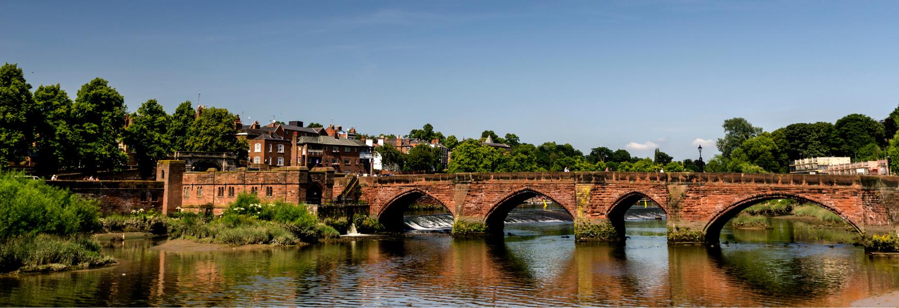
Waterside Walks in Cheshire

Waterside Walks

Waterside Walks

Searching for...

  • Things to Do

What's On Search

Dates
Type:
Area:
Location
Keyword:

Things to Do Search

Type:
Area:
Location
Keyword:
Facilities
Accessibility
Children & Infants

Accommodation Search

Check Availability
Arrival Date:
Add Room
Type:
Area:
Location
Keyword:

Food & Drink Search

Type:
Area:
Location
Keyword:

Shopping Search

Type:
Area:
Location
Keyword:

Number of results:

Number of results: 42

, currently showing 1 to 20.

  1. Add Nelson Pit Walk 8 to your Itinerary

    Nelson Pit Walk 8

    Type

    Type:

    Walking Route

    Higher Poynton

    A pleasant ramble on the Middlewood Way, across fields and along the towpath of the Macclesfield Canal. Part of the walk, crossing from the Middlewood Way to the Canal can be muddy.

  2. Add Walks for All - The Weaver Parkway to your Itinerary

    Walks for All - The Weaver Parkway

    Type

    Type:

    Walking Route

    Winsford

    The Weaver Parkway is an extensive area of open green space alongside the River Weaver on the outskirts of Winsford. It was created on former industrial land of brine workings and salt mining, creating a unique habitat for unusual wildlife.

  3. Add Malkins Bank Circular Walk to your Itinerary

    Malkins Bank Circular Walk

    Type

    Type:

    Walking Route

    Sandbach

    This area once contained thriving industries due to large underground salt deposits. Large works were constructed and brine shafts sunk to extract the salt.

  4. Add The Carrs - Walks for All to your Itinerary

    The Carrs - Walks for All

    Type

    Type:

    Walking Route

    Wilmslow

    This walk follows the River Bollin for just under a mile from Wilmslow town centre to Twinnies Bridge.

  5. Add Alsager Series No. 5 – Salt Line and Canal to your Itinerary

    Alsager Series No. 5 – Salt Line and Canal

    Type

    Type:

    Walking Route

    Church Lawton, Alsager

    This route, devised by Alsager Chamber of Trade, is one a series of walks in the Alsager area. The walks have been published in leaflets entitled ‘It’s all about Alsager - Walking Maps of Alsager’.

  6. Add Trent and Mersey Canal - Walks for All to your Itinerary

    Trent and Mersey Canal - Walks for All

    Type

    Type:

    Walking Route

    Middlewich

    This level canal-side towpath walk offers a great insight into the waterway’s corridor as it flows through the town of Middlewich. In
    contrast to the busy roads, slow down to the pace of life of the canals.

  7. Add Nelson Pit Walk 5 to your Itinerary

    Nelson Pit Walk 5

    Type

    Type:

    Walking Route

    Higher Poynton

    One of a series of walks from the Nelson Pit Visitor Centre. The route through Poynton Coppice is pretty at any time of the year. The majority of The Coppice is owned by Cheshire East Council and is subject to a ten-year management plan.

  8. Add Nelson Pit Walk 9 to your Itinerary

    Nelson Pit Walk 9

    Type

    Type:

    Walking Route

    Higher Poynton

    The first part of two walks making the Middlewood Challenge, a 20-mile walk in the figure of eight. The second section of the Challenge is Walk 10 which is about 12 miles long and takes around 5 hours to walk.

  9. The Weaver Way

    Type

    Type:

    Walking Route

    Audlem

    Stretching from Frodsham in the north to its most southerly point at Audlem, the route leads you along the River Weaver and Navigation, as well as the Trent and Mersey, and Shropshire Union Canals.

  10. Add Nelson Pit Walk 10 to your Itinerary

    Nelson Pit Walk 10

    Type

    Type:

    Walking Route

    Higher Poynton

    The second part of two walks making the Middlewood Challenge, a 20-mile walk in the figure of eight. The first section of the Challenge is Walk 9 which is about 8 miles long and takes around 3½ hours to walk. Total walking time for both parts is arou

  11. Add Walks for All - Macclesfield Forest to your Itinerary

    Walks for All - Macclesfield Forest

    Type

    Type:

    Walking Route

    Macclesfield

    Macclesfield Forest is the last remnant of the Royal Forest of Macclesfield and is now a working forest managed by United Utilities.

  12. Add Walks for All - Anderton Nature Park to your Itinerary

    Walks for All - Anderton Nature Park

    Type

    Type:

    Walking Route

    Northwich

    Anderton Nature Park provides a haven for wildlife on restored industrial land adjacent to the historic Victorian boat lift and near to Northwich town centre. For the full story behind the Park’s creation visit www.andertonstory.org.uk.

  13. Add Chester Centre 3.3 Mile / 6km Circular Walk to your Itinerary

    Chester Centre 3.3 Mile / 6km Circular Walk

    Type

    Type:

    Walking Route

    Northgate Street, Chester

    Take in the historic city of Chester on this scenic circular walk.

  14. Two Locks Walk

    Type

    Type:

    Walking Route

    Northwich

    This is a beautiful waterside walk that takes in the historic Hunts Lock and Vale Royal Locks. Walkers will be enchanted by the number of bird species that can be seen and heard along the way.

  15. Add Nelson Pit Walk 6 to your Itinerary

    Nelson Pit Walk 6

    Type

    Type:

    Walking Route

    Higher Poynton

    The route follows the Macclesfield Canal north and then along wide country tracks before an uphill stretch into Lyme Park. The views from the highest point near Lyme Park on a good day are spectacular.

  16. Add Hunts Lock to Blue Bridge Circular Walk to your Itinerary

    Hunts Lock to Blue Bridge Circular Walk

    Type

    Type:

    Walking Route

    Northwich

    This is a lovely waterside walk that crosses Hunts Lock and the recently reinstated Riversdale Bridge.

  17. Add Lawton Woods Loop to your Itinerary

    Lawton Woods Loop

    Type

    Type:

    Walking Route

    Liverpool Road West, Church Lawton

    The name Lawton originates in the Lawton family with its family crest being the head of a bleeding wolf. Local legend talks about a man saving the Earl of Chester from being killed by a wolf.

  18. Add Bollington Circular Walk 4 to your Itinerary

    Bollington Circular Walk 4

    Type

    Type:

    Walking Route

    Bollington, Macclesfied

    The fourth in a series of circular walks around Bollington and Kerridge starting from the Rangers Office, Adlington Road.

  19. Add Nelson Pit Walk 3 to your Itinerary

    Nelson Pit Walk 3

    Type

    Type:

    Walking Route

    Macclesfield

    One of a series of walks from the Nelson Pit Visitor Centre. One of the main features of this walk is Poynton Coppice.

  20. Add Nantwich Riverside Loop to your Itinerary

    Nantwich Riverside Loop

    Type

    Type:

    Walking Route

    Nantwich

    Stretch your legs on this pleasant walk from the town centre, taking in the Riverside Park, the Shropshire Union Canal and the historic Welsh Row. Just follow the signs in either direction and enjoy getting to know the countryside and its history.

Don't Miss

Don't Miss

Don't Miss

Don't Miss

Don't Miss

Don't Miss

Don't Miss

Don't Miss

Don't Miss